
Montgomery County is seeking assistance from community members to help identify flood-prone areas. It has established a new website that includes a short, confidential survey where residents can provide feedback on flooding experiences and insight. On Thursday, Oct. 20, the County will hold a virtual community meeting on its Comprehensive Flood Management Plan.
At the meeting, representatives from the County’s Department of Environmental Protection will explain the plan and will participants fill out the survey.
The virtual meeting will be held at 6:30 p.m. on Thursday, Oct. 20. Register at Comprehensive Flood Management Plan Virtual Community Forum.
The County recently unveiled the new website to educate and inform the public about flooding issues that may affect residents and businesses throughout the County. The website provides information about frequently flooded roads, steps residents can take to prepare for potential flooding and the availability of flood insurance to all properties in the County.
The County is committed to addressing adverse flood impacts to residents and businesses in the County.
The web address is https://www.montgomerycountymd.gov/flooding/. The page also can be found on the County’s homepage.
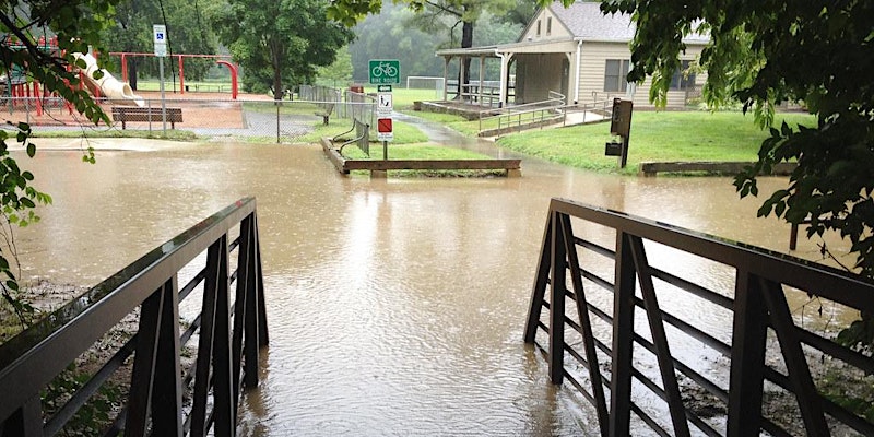
Flooding is the most frequent severe weather event and the costliest natural disaster. Floods not only affect high-risk coastal areas, but according to the Federal Emergency Management Agency (FEMA), 25 percent of flood insurance claims come from moderate-to-low-risk areas like Montgomery County. Just one inch of floodwater can cause up to $25,000 in damage.
The County is developing the comprehensive flood management plan to better understand the causes and impacts of flooding—and potential strategies to eliminate or minimize the risks of flooding. In June, the County announced a new high-tech flood sensor program to provide earlier alerts to residents about potential flooding.
“We know that climate change impacts Montgomery County in two major ways: heat and flooding,” said County Executive Marc Elrich. “That is why we are mapping heat islands in the County to identify potential areas where we can take action to protect vulnerable neighborhoods. That is also why we will use the flood management plan to identify flood-prone areas and potential strategies to minimize flooding in the future.”
The County is seeking assistance from community members to help identify flood-prone areas. The new website includes a short, confidential survey to where residents can provide feedback on flooding experiences and insight.
For more information on the flood sensors go to: https://www.montgomerycountymd.gov/water/Resources/Files/stormwater/Fact-Sheet-Flood-Sensors.pdf
For questions on the Comprehensive Flood Management Plan, email Stan Edwards, DEP division chief, at stan.edwards@montgomerycountymd.gov.